When planning a trip to Nusa Penida, travelers often look for clear and practical ideas on what to do and how to get around. To make things easier, I’ve put together four ready-to-use self-drive itineraries that combine the island’s most beautiful and iconic spots — plus the guided day tours we run if you’d rather not handle the logistics yourself.
These routes start with the easiest and most accessible areas, using well-maintained roads that can be explored by scooter or car, making them suitable for most visitors. Each itinerary can be combined or adapted depending on how much time you have. To get a full overview of my favorite places in Nusa Penida — including both land attractions and underwater highlights — you can also refer to the Nusa Penida map. If you are unsure whether to rent a scooter, hire a private driver or join a guided tour, see my complete guide on how to get around Nusa Penida.
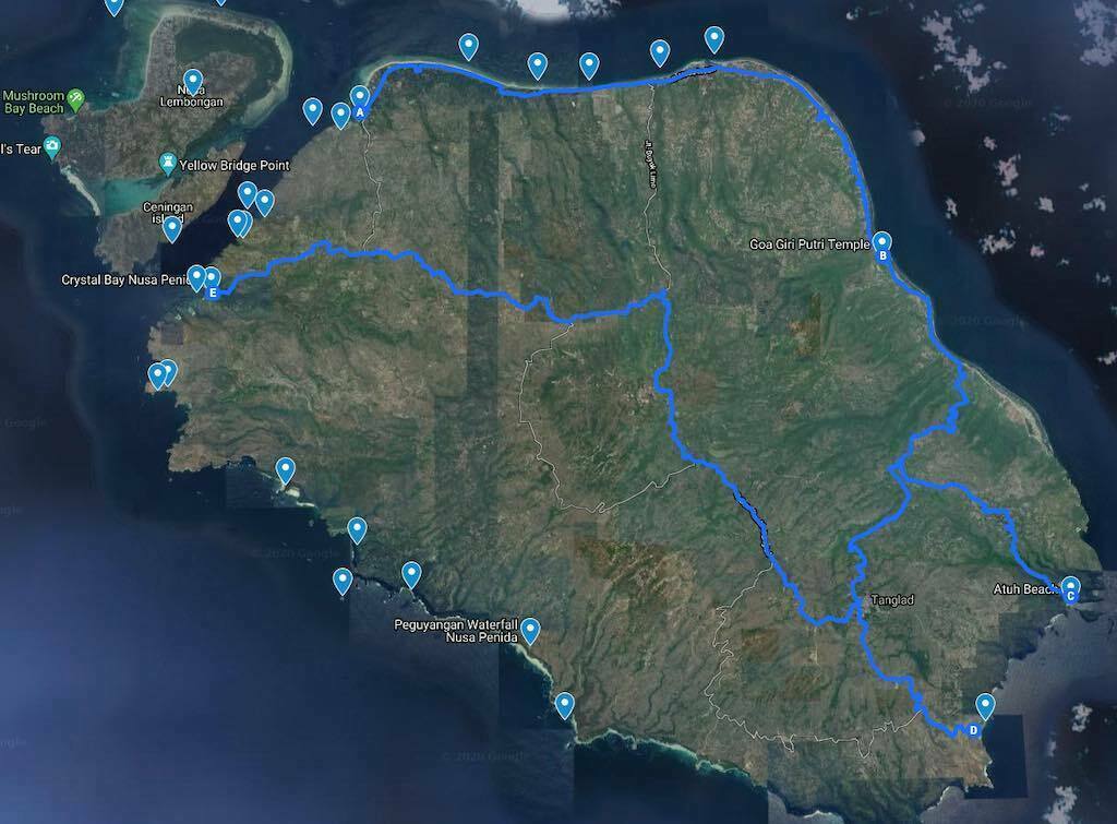
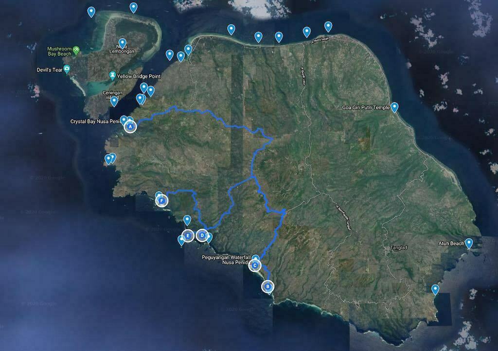
Nusa Penida map and itinerary overview
Use this Nusa Penida map with attractions to locate the main beaches, temples, viewpoints, dive sites and road routes before choosing your itinerary.
How many days do you need in Nusa Penida?
| Time available | Best choice |
| Half day | West coast highlights if you are already on the island |
| 1 day from Bali | Choose either the west coast or the east coast, not both |
| 2 days / 1 night | East coast + west coast at a relaxed pace |
| 3 days or more | Add Crystal Bay, Gamat Bay, sea trips, hiking or diving |
Explore Nusa Penida on your own or with a guided tour
The four itineraries below are built for self-drive (scooter or private car). If you’d rather have everything organised — fast boat from Bali, private driver-guide, lunch — we run small-group guided day trips that cover the same ground:
- West Nusa Penida Tour — Kelingking, Crystal Bay, Broken Beach & Angel’s Billabong, with fast boat, driver and lunch organised for you.
- East Nusa Penida Tour — Goa Giri Putri, Atuh Beach & Diamond Beach, ideal if you want the quieter and more scenic side of the island.
- 2 days / 1 night in Nusa Penida from Bali — both coasts at a relaxed pace, with one night on the island and time for sunset.
Don’t want to drive? Roy can help organise your fast boat, private driver and day tour, so you can explore Nusa Penida without worrying about the roads or timing.
2 days in Nusa Penida
If you have two days, the best plan is simple: spend one day on the west coast and one day on the east coast. This avoids rushing, gives you better light for photos, and leaves time for a sunset or a swim at the end of the day. If you are coming from Bali, see the 2 days / 1 night Nusa Penida itinerary.
Itinerary 1 — The east coast: Goa Giri Putri, Atuh & Diamond Beach
The road is very good on almost the entire route, which makes it one of the easiest itineraries. Please schedule at least half a day and preferably a full day.
Prefer it done for you? See our East Nusa Penida Tour, including Goa Giri Putri, Atuh Beach and Diamond Beach.
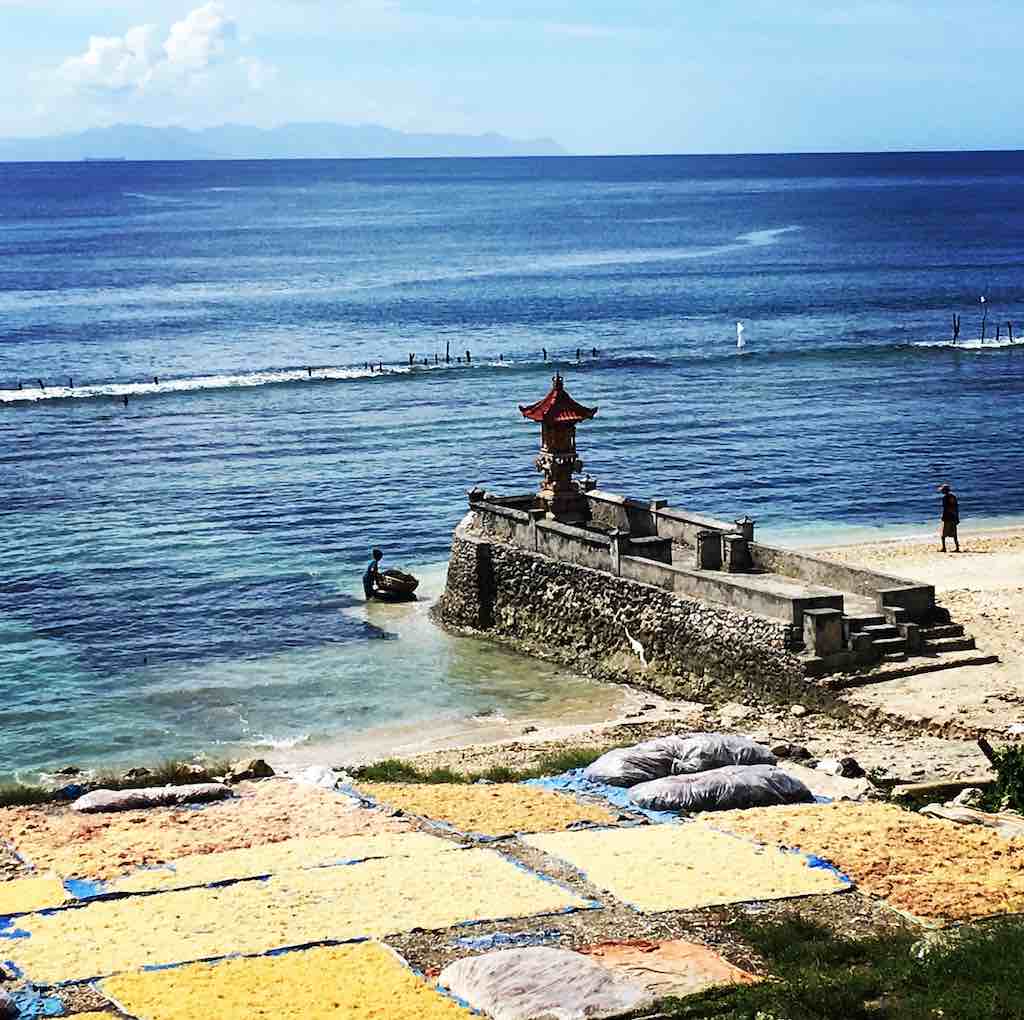
From Toyapakeh to Goa Giri Putri
After leaving Toyapakeh Harbour, you will reach Goa Giri Putri Temple after 30 minutes. You will follow the north coast of the island where tourism has developed the fastest, especially between Ped and Sampalan. However, there are still seaweeds crops near Suana which offer the opportunity for beautiful photos. If there are not too many clouds you will have a magnificent view of Mount Agung.
If you have time, outward or return, you can take a short detour to Limo about halfway. There you will find artisans who create silver jewelry.
Goa Giri Putri’s visit is a great moment. The entry into this huge cave through a small opening, the route through the purification stations and the final Trimurti ceremony will no doubt leave you with great memories.
Plan a lunch stop
If you have not had lunch, it is best to do so before leaving the coast as there will not be many opportunities before reaching Atuh Beach. But you will still find drinks, fruit juices, grilled fish and basic dishes at Atuh Beach. If you arrived through Diamond Beach, take the path down along the cliff, at least until the staircase cut in the heart of the rock of the cliff.
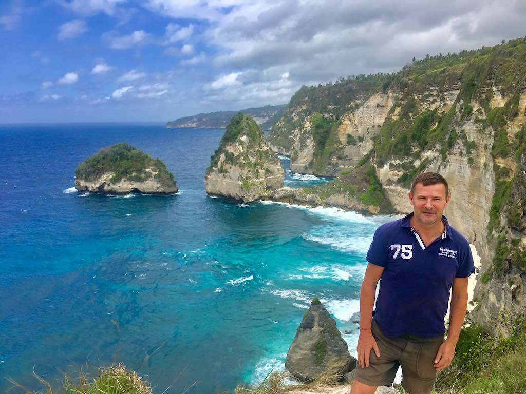
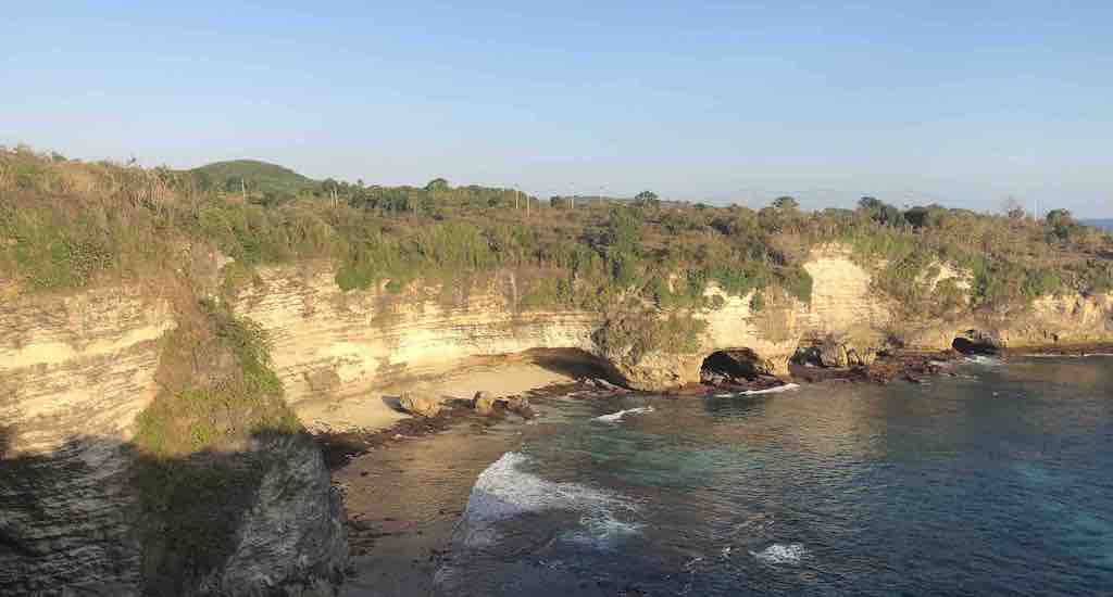
Atuh Beach
The signage to get there is a bit confusing. You will often see two Atuh Beach signs, one pointing left, the other right. In fact there are several routes to the beach, on the left or the right. The access on the left side is shorter but the descent to the beach is steeper. My advice is to arrive on the right side, which offers a more beautiful panorama: whenever the choice is offered, take the right lane! Or more simply, type Diamond Beach into Google Maps.
From there you will have a hundred meters to walk on a ridge line. With a little luck, from the top of the cliff, you can see Manta rays: look for dark shapes that stand out against the blue of the sea. Either way you can take spectacular photos! Then all you have to do is climb down the 126 concrete steps to the beach. Beautiful beach, crystal-clear water, but like everywhere in Nusa Penida watch out for waves and currents.
Return circuit
If you are coming from Sakti a good option is to return via Tanglad and the interior of the island, because the road has also been redone. You will find handicrafts of local fabrics in Tanglad. If you have time you can also take a detour to Suwehan beach (detour twice 20 minutes), or to the hills called Teletubbies (detour of 2 times 5 minutes) and Sekartaji (detour of 30 minutes). Or continue with one of the other routes that cover the south-east of Nusa Penida (Tanglad, Suwehan, Teletubbies, Sekartaji).
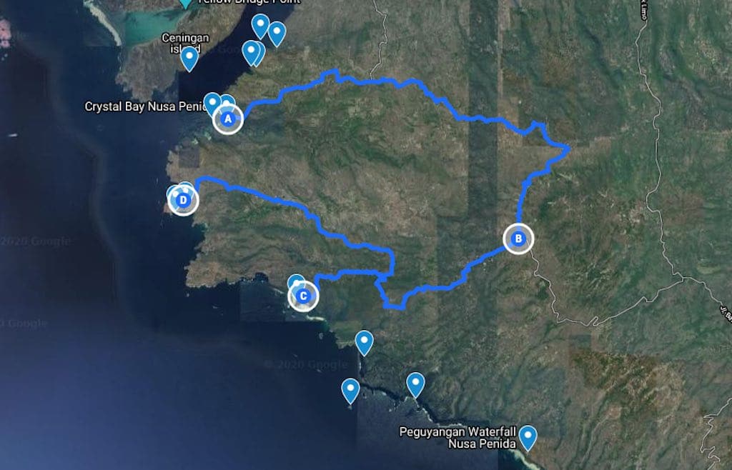
Itinerary 2 — The south-west coast
The south-west coast of Nusa Penida offers some very beautiful sites, still relatively little visited. The distances are short but journey times are still quite significant because the renovation of the road network is not complete. After several route tests, I suggest this one, which I think is optimised in the current state of the roads.
Manta Point and Guyangan Waterfall
From Toyapakeh or Crystal Bay you can reach Guyangan Waterfall in around 45 minutes via Batukandik. The road has been redone almost entirely. Just before arriving at Guyangan you will see a small Manta Point sign pointing to the left. It is a small detour of about twenty minutes in total, but when you get to a small white temple you will normally see Manta rays from the top of the cliff. However, there is no way to go down to sea level to swim with them — you will need to contact a diving center for that.
Guyangan Waterfall is a very beautiful place with a breathtaking view. If you are not dizzy you can descend the blue staircase which leads to sea level, to a small temple (plan to bring a sarong) and to small natural baths on the cliff side!
Tembeling and its primary forest
From Toyapakeh or Crystal Bay you can reach Tembeling in about 40 minutes via Batumadeg. The road has been redone almost entirely. If you come from Peguyangan, you still have to go back to Batukandik and then to Batumadeg, around 30 minutes by scooter. If you have your own scooter you can practically descend to the bottom and park it in the “parkir” area. The descent into the primary forest, on scooter then on foot, is quite impressive. If you came by car you will probably find a scooter driver on site who can drive you down. Otherwise, the bravest can walk, but that makes a hike of more than two kilometers… A small staircase has recently been built to descend to the beach. On the way you pass a large natural swimming pool. A few hundred meters further down you reach the beach, which is very wild — visitors have started to build fairly poetic pebble pyramids. Allow a good hour on site if you go down to the beach.
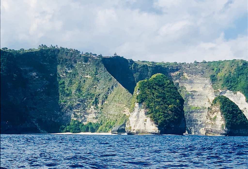
Banah Cliff
Continue the 5-minute drive to Banah Cliff, from where you will have a breathtaking view of Batu Bolong. Literally it means “rock with a hole” — very colorful and very explicit when you see the rock (or its photo)! It is this rock that inspired the logo of Warnakali restaurant.
Itinerary 3 — The west coast: Kelingking, Crystal Bay & Broken Beach
This itinerary takes a good half day, or a big day if you combine itineraries 2 and 3.
Prefer it done for you? See our West Nusa Penida Tour, including Kelingking, Crystal Bay, Broken Beach and Angel’s Billabong.
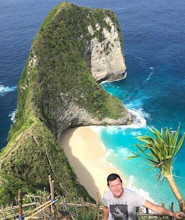
Kelingking Beach
Going back through Batumadeg and taking a small road on the left (which deserves to be redone), you reach Kelingking Beach in 20 minutes from Tembeling, or about 45 minutes from Crystal Bay. The site was still deserted until April 2017 but has grown a lot since. You will find several warungs where you can drink a fruit juice or eat a nasi goreng. Do not ride along the cliff with your scooter — there have already been accidents and deaths.
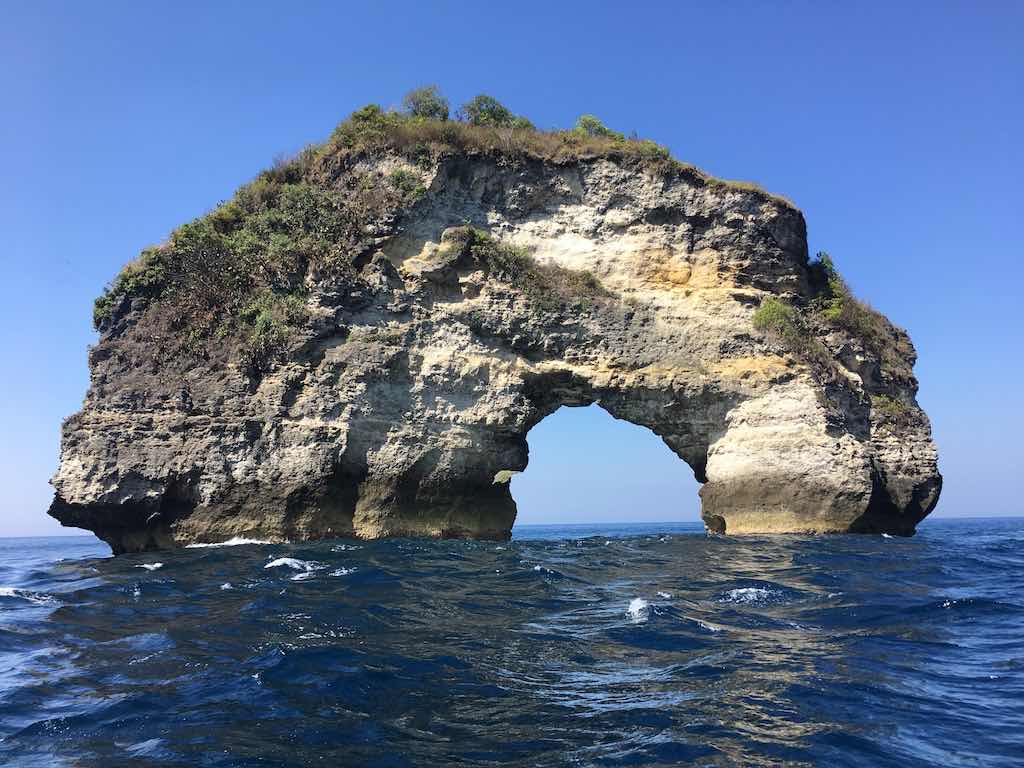
Broken Beach and Angel’s Billabong
The road to Broken Beach and Angel’s Billabong used to be a disaster, but it is now brand new almost to the end. You can have a drink or a bite to eat in one of the warungs that have recently grown up there.
Itinerary 4 — Crystal Bay & Gamat Bay (sunset)
After itinerary 3 you can continue with a walk to Crystal Bay or Gamat Bay to end the day with a beautiful sunset. If you want a drink by the pool or a bite to eat facing the sunset, check out Amok Sunset. They have happy hour on cocktails between 5 and 6 p.m.
Hiking
There aren’t really any marked hiking trails yet, as there can be in Europe. But for good walkers here are two suggestions.
Tembeling
Instead of descending by scooter into the Tembeling valley, some do it on foot. The path is well laid out since the scooters take it, but it goes down on the way there — and so it goes up on the return! It takes 2 hours there and back, without hurrying too much, my friend Cathy tells me after doing it recently.
Walking from Crystal Bay to Broken Beach
The path from Crystal Bay to Broken Beach on foot is not really marked (or at least I did not find it), so it is imperative to go with proper shoes. But it’s very beautiful.
Sea trips in Nusa Penida
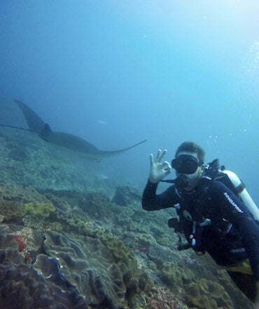
Most travelers choose a sea trip with one objective: snorkeling or diving. And often a second objective: to see Manta rays.
The snorkeling trip to Manta Bay
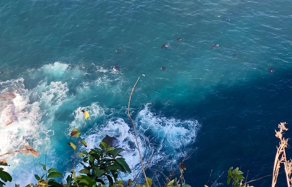
The small boats that leave from Toyapakeh or Crystal Bay to bring tourists to see the Manta rays generally go to Manta Bay — the bay you can see from Angel’s Billabong and Broken Beach. It’s best to go early to avoid the stress of swimming with a mask, fins and snorkel in the middle of a swarm of boats and other snorkelers. Manta rays are often there, but not always; the first boat to spot them signals it to the others. It can also happen that they are just below Broken Beach arch and can be seen very well from the cliff.
The snorkeling tour usually also includes Crystal Bay and/or Gamat Bay, and sometimes the mangrove at Nusa Lembongan.
Sea trip to Manta Point
Dive centers normally go (unless they want to save fuel…) to Manta Point. This is where the Manta Ray cleaning stations are located. The journey takes around 40 minutes and is very beautiful, especially in the early morning when there is sometimes a mist lining the surface of the sea. The waves crashing on the cliffs of Nusa Penida can also be quite spectacular seen from the sea.
From the port of Toyapakeh you pass in front of Gamat Bay then Crystal Bay before crossing Manta Bay. You’ll probably see Angel’s Billabong’s natural pool and perhaps Broken Beach’s arch. Along the route you will also likely see anglers at the top of the cliffs or on a rock.
You will then pass Kelingking Beach, Batu Bolong, Tembeling then Guyangan before arriving at Manta Point.
Plan Your Trip to Nusa Penida
Before leaving, take a moment to complete your travel planning. If Nusa Penida is part of a broader journey, you may find it useful to plan your trip to Bali before heading to the island. For a full overview, don’t miss our complete travel guide for Nusa Penida, which brings together everything you need to know in one place. You’ll also find helpful practical information about Nusa Penida, covering transport, getting around, and essential tips. Finally, if you’re still deciding what to prioritize, explore the top 15 places to visit in Nusa Penida to make the most of your time on the island.
Nusa Penida Travel Guide
Plan your trip to Nusa Penida with our local expert guide: beaches, diving sites, hotels, transport tips, itineraries and seasonal advice.
![Adiwana Warnakali PADI 5 star dive resort pool and deck[:id]Adiwana Warnakali PADI 5 star dive resort Nusa Penida Bali[:]](https://nusapenida.org/wp-content/uploads/2022/05/Adiwana-Warnakali-PADI-5-star-dive-resort-Nusa-Penida-Bali.jpg)
Where to stay in Nusa Penida
How to choose where to stay in Nusa Penida among the 500 listed hotels. 5 stars, boutique hotel, glamping or charming bungalows?
Top 15 to see in Nusa Penida
After more than 10 years exploring Nusa Penida, I’ve updated my list of the 15 most incredible places to see on the island — from stunning beaches to dramatic cliffs.
Hello Blaise,
I would love a copy of the map. I would be helpfull for me, I’ll be on Penida this month.
Thank you!
LAurens
Hi Laurens, I sent you a copy of Nusa Penida map ! Enjoy your stay in the island. Blaise
Would you mind sending me the hi res map of the island please
Hello,
I sent you the map. Enjoy your stay in Nusa Penida !
Blaise
I would love a copy the map. I just sent you a WhatsApp message also.
Hello Victoria,
I sent you by email the Nusa Penida map.
Enjoy your stay in Bali!
Blaise
Would you mind sending me the hi res map of the island please
Hello Mark,
I sent you the pdf map.
Enjoy your stay in Nusa Penida !
Blaise